Fighting the Burn
As wildfire risk continues to increase nationwide, TPL is taking action to fight fire with land conservation. Fueled by data and supported by local and state partnerships, our work is fluid and ever shifting to meet the needs of the communities we serve.



In spring 2025, TPL’s Northern Rockies Director David Weinstein and Hugh Coxe, a project manager and leader of our California wildfire resilience program, appeared on Past Forward’s The Fire Problem podcast. The series is billed as an educational program that explores the growing frequency and intensity of wildfires in California and around the world. Weinstein and Coxe spoke with host Jon-Barrett Ingels about how wildfires are influencing TPL’s approach to conservation. Throughout the hour-long conversation, they dug deep into the challenges wildfires present to our efforts to provide healthy, equitable outdoor spaces for all. (Listen to the full episode here.)
Here, we unpack some of the key takeaways from the conversation, with expanded details and commentary from Weinstein and Coxe about a threat that isn’t going to burn out anytime soon.
ON THE DRAMATIC INCREASE IN WILDFIRE FREQUENCY AND INTENSITY
DAVID WEINSTEIN: Climate change is an existential threat that affects everything we do. It keeps many people up at night. We’re learning that this is an all-hands-on-deck approach. Every organization, every business, every person has their own lane in which they can work to do better on behalf of the crisis we’re facing collectively.
Trust for Public Land works with communities across the country that are facing a wide range of climate impacts. Some confront harsher realities and more immediate risk, like California, but it’s now imperative everywhere to become proactive, not reactive. We hear a steady drumbeat of feedback from partners, local officials, and stakeholders who look to us for conservation-forward strategies.
One of our signature projects in California was conserving the land that holds the Hollywood Sign in Los Angeles. We did that in 2010, not only to protect a culturally significant landmark that was being threatened by development, but also to ensure incredible recreational access for residents and visitors to the city who can hike the sign’s Cahuenga Peak, now part of Griffith Park.
The most recent Los Angeles–based fires underscore that we safeguarded more than important iconography. That conservation effort, completed 16 years ago, created a buffer for communities that we serve who might have otherwise been in direct danger. It’s an example of what we are now looking at in nearly every project we undertake.
HUGH COXE: We are very focused on climate conservation—looking at all of our conservation and park projects through a climate lens, for the health of the land, the health of the wildlife, and the health of people. It takes a lot of different shapes and a lot of different forms.
Schoolyards are a great example. In L.A. and elsewhere, they’re generally paved in asphalt and often don’t have shade. They heat up quickly, sometimes reaching surface temperatures well over 120 degrees, and they retain and radiate that heat. At some schools, the heat anomaly—the difference in average temperature between the schoolyard and the surrounding city—exceeds 20 degrees.
So with TPL’s community schoolyards program, we find ways to transform the spaces, adding plenty of trees for shade and cooler surface materials. Places like these, that make neighborhoods healthier and more livable as the world heats up, will serve a lot of people, especially in urban areas.
In a very different approach, we look at large landscape-scale conservation to make sure that there’s refugia for wildlife—places that contain many well-connected microclimates with robust biodiversity. It’s important to know that those places will continue to be available and accessible to wildlife as climate change pushes them to higher elevations and shifts their migration paths.
One of our projects in the Transverse Ranges region, the Wind Wolves Preserve, is a great example. Ranging from 640 to 6,005 feet above sea level, the preserve includes an array of landscapes and habitats that serve as critical wildlife corridors and are home to numerous species, such as the San Joaquin kit fox and blunt-nosed leopard lizard.
So it really ranges. We’re looking at it, we’re mapping it, we’re analyzing the projects at the micro and macro scale. For example, a single, relatively small schoolyard delivers important outcomes at the micro, local level. When that approach is repeated and multiplied in cities and towns across the country, as we’re doing with our schoolyards program, that’s macro-scale systems change.
When it comes to our landscape work, we look at patterns in historical wildfire data and do future modeling to identify buffer zones with high potential for long-term resilience. The literature on climate change suggests you get spikier spikes, so to speak: The droughts are longer and more unforgiving; the wet years are wetter and last longer. And both of those can work to increase fire hazard. There’s quite a bit of evidence that these variations are going to be more extreme as a result of climate change. We’re always thinking about how to use land conservation as a natural solution to those effects.
DW: Fire ecology is becoming sophisticated enough to understand how TPL’s work can deliver preventative action and to make sure that communities are adapted and ready for these catastrophic wildfires. Everybody’s holding their breath. We all know that wildfires are going to continue to pop up, and they’re going to result in more loss of property and life. Communities can and should understand how wildfire moves from the backcountry into urban areas, and they should focus on hardening their built environments to protect themselves and their neighbors.
These catastrophic fires with the wind events that we’ve seen in places like California are pushing embers up to 5 miles, often across the wildland-urban interface into communities. We’re seeing more policies enacted around building standards, such as fire-resistant fencing design and material, shrubbery setbacks, covered vents on houses, and other solutions to harden homes against wildfire. We’re thinking more carefully about how people are building into the wildland-urban interface.
ON CLIMATE CHANGE AND FUNDING STRATEGIES
DW: There’s more and growing recognition among the general public and among philanthropic donors about the risks of wildfire. We know that forests need lots of fire to maintain a healthy, balanced ecosystem. There’s also more recognition about all the health risks and impacts of fire, like air quality, not just direct fatalities. Our supporters and donors see the throughline between fire-resilience funding and human- and environmentalhealth outcomes. We live in interconnected systems, and fires are not isolated. Those massive fires in Canada in 2023 covered about 50 million acres. This is the size and scale that reaches around the globe.
Conservation finance at Trust for Public Land began in 1996, and we’ve long been in Washington, DC, making sure that we’re working with federal agencies and Congress to appropriate the kind of funds that we need to do conservation work—and that includes wildfire mitigation efforts. Public opinion research is one major step in this process. Our pollsters have traditionally talked about three w’s that matter: water, wildlife, way of life. These things resonate with communities everywhere. Within the last 10 years, we’ve seen a fourth w pop up, and that is wildfire.
Part of the shift in our approach over the last decade or so has been to work with fire chiefs and other policy experts in the wildfire space, putting packages in front of voters that impact all four of the w’s that matter to them. Voters are saying yes, because they understand the threat. We expect to see growing support at federal, local, and individual levels for conservation strategies that address climate risks, especially wildfire.
ON WILDFIRE RESILIENCE AND MAPPING EXPERTISE
HC: Trust for Public Land’s wildfire resilience program, which started in Southern California, flows out of work we did in the Transverse Ranges (see project highlights below). One of the impacts of increased development is an increased wildland-urban interface, especially throughout the West. We’ve seen it quite a bit in California, and there’s a lot of literature out there to suggest that the increases over the last couple of decades in housing and infrastructure put people in harm’s way, but also potentially create ignition sources.
Our spatial analysis experts have used geographic information systems (GIS) to create a series of maps in order to identify and prioritize where we want to invest our time and our money to achieve wildfire mitigation and prevention. They look at topography, weather patterns, fuel moisture, and vegetation types as well as land management and fire histories.
We leverage our data and maps with those of other specialists to maximize results. For example, California has a set of high-fire-hazard severity maps that assess the lay of the land—things like the aspect and the steepness of slopes. They also have data on fire history and potential fuel sources in a given area. Some of those are relatively static over time, and some are pretty dynamic. Fuels, particularly in Southern California, can change dramatically from season to season.
Layering that information over features such as critical habitat, existing infrastructure, and residential developments helps reveal areas that are at risk. We use all of the data sources we can to identify high-risk areas, and having our own geospatial team is extremely useful. And we’re leveraging our proprietary data with experts and local communities across the state to enhance our mapping capabilities for pinpointing areas of risk. When we share and build on this information with our partners, the sum is truly greater than the parts. It’s becoming a model for how we approach our work in other places.
ON INDIGENOUS LAND- AND FIRE-MANAGEMENT STRATEGIES
DW: Indigenous peoples have been burning productively and safely for millennia. The 20th century kind of annihilated those traditions and that knowledge. But now we’re learning from Indigenous peoples and not trying to compartmentalize their cultural practices and knowledge into a Western viewpoint about how fire ecology works.
There are several examples in California where TPL has negotiated complex agreements in order to return forest stewardship to Tribal nations, from the Kashia Band of Pomo Indians on the central coast to the Amah Mutsun Tribal Band near Monterey Bay. Their leadership will facilitate restoration and conservation using traditional and contemporary Indigenous knowledge and methods (see project highlights below).
HC: In California, our forest health task force has robust discussions in public sessions where they talk about things such as traditional Tribal practices like prescribed burning and barriers to implementing those, as well as how to take these broad state-level goals and rightsize them at the community level and for specific projects.
DW: We’re seeing more fire-minded community networks pop up. Many of these groups include wildfire specialists, and they’re working closely together, partnering with TPL and other organizations to advance our collective wildfire prevention capabilities.

Sardine Meadow
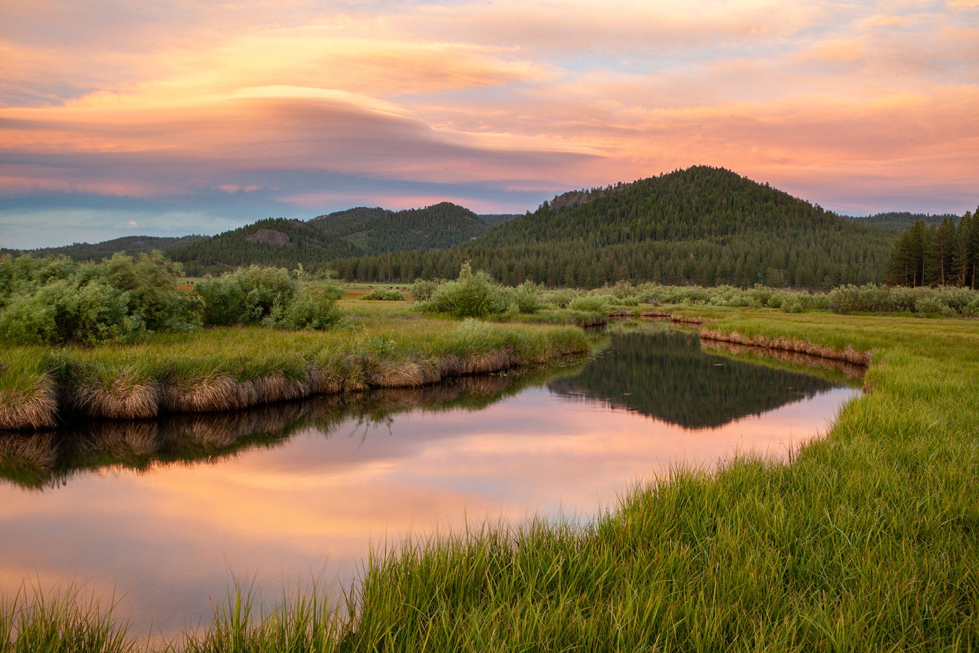
In the northern Sierra Nevada, TPL protected 569 acres of meadows and other natural areas near the historic mountain town of Truckee that provide nearby communities with natural fire prevention. Firefighters use meadows to control wildfires; with greater water retention and fewer trees, they work as natural firebreaks.
North Campus Open Space
A restored wetland that was once the site of a nine-hole golf course, North Campus Open Space near Santa Barbara is truly a landscape reborn; TPL helped launch its new life as a birding paradise by protecting 64 acres in 2013. Now, UC Santa Barbara is partnering with the local Chumash community to conduct prescribed fires and raise awareness about sustainable practices of Indigenous land management.
Crooked Palm
In 2025, TPL protected over 100 acres near an urban area in Ventura County, within the Transverse Ranges. This land, once an oil refinery, will be restored as a public natural area, improving access to the Ventura River and adding a new connection to the popular Ventura River–Ojai Valley Trail, all while acting as a natural firebreak and reducing wildfire risk to nearby communities.

Donate to become a member, and you’ll receive a subscription to Land&People magazine, our biannual publication featuring exclusive, inspiring stories about our work connecting everyone to the outdoors.
