Atlanta’s South Fork Conservancy (SFC) was founded in 2008 with the goal of conserving the South Fork of Peachtree Creek, restoring its habitat, and connecting communities to the creek, parks and greenspace. “Nature is central to us. We want people to connect with nature in the heart of the city. Often, the best place for that to happen is along our creeks,” says Executive Director, Kimberly Estep.
A small grassroots nonprofit, SFC did not hire its first full time employee until 2016, and still maintains a staff of just one. Until recently, the South Fork Conservancy had largely focused on volunteer-led creek restoration and trail building projects. Kimberly first heard of ParkServe while attending a conference in Atlanta. “Maps were being passed around and I asked ‘Where are these from?’ I found out about it at just the right time.”
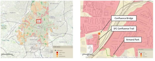
SFC found that neighborhoods surrounding the confluence of the North and South Forks of the Peachtree Creek were a park desert, despite the fact that SFC had recently completed trails along both waterways.

The South Fork Conservancy used ParkServe’s mapping and analytics capabilities to show that the project was located in a high need area, and that a pedestrian bridge would drastically improve greenspace access.
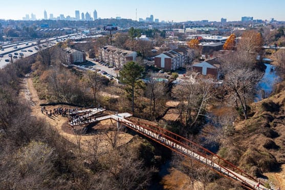
Connecting the two trails and creating park access for the community would require SFC’s biggest project to date: a 300-foot pedestrian bridge and ADA ramp. “It was critical,” recounts Estep. “It was the only place we could connect our trails to each other. It gave really dense neighborhoods access to the nature trails. They previously had to drive there even though they were right next door.” In addition to trail access, the bridge would also connect the neighborhood to nearby Armand Park.
But realizing the need for a pedestrian bridge was only the first step. Bridges are expensive and require government oversight and approval. With the Confluence Bridge, the situation was particularly complicated. “It was on Georgia Department of Transportation land and some of it was on private property. The project also involved the City of Atlanta Parks and Recreation Department, Georgia Department of Transportation, and City of Atlanta planning department. It was very complex. To make it work, we had to get government officials to buy in.”
Throughout the process, the data and maps provided by ParkServe were invaluable tools for building support and securing funding. “The site also had topography issues and loads of utilities. With such a challenging site, I was often asked, ‘Why here?’ ParkServe gave me the back-up I needed to prove why it had to go in this precise location.”
“Making this important connection was all about the thousands of families we were going to create access for. I would always start out my reports with the “why” and use the maps, show the park desert, and give the numbers. The maps were incredible. People love the visuals,” said Estep.
SFC also found ParkServe’s analytic capabilities highly effective when applying for funding. “We used ParkServe to show that 2,800 people would now have direct access to green space,” said Estep. “To be able to have access to that information for grants was incredibly useful.”

Completed in 2021, Confluence Bridge has connected 2,800 Atlantans to walkable access to green space.
Using ParkServe data and maps to advocate and fund-raise, South Fork Conservancy was able to make the Confluence Bridge a reality, gaining approval from various city and state government agencies and raising over $2.5 million dollars for the project. The bridge opened to the public in December of 2021.
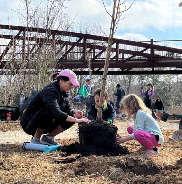
The community response to the new bridge has been dramatic and immediate. “Every time I visit the bridge there is always someone new there. They are so ecstatic to have a brand-new park in their backyard. It is changing the quality of life in this neighborhood, and you can see how happy people are as they explore the trails.” Estep says the community support for the project is also visible in the growth in stewardship. “Dozens of people joined us to plant trees in the wet Georgia clay, so they must love it. They are signing up to volunteer and to give back to this special place in their neighborhood, this unique amenity.”

Since completing Confluence Bridge, South Fork Conservancy has seen a dramatic increase in stewardship. Image credit South Fork Creek.
Reflecting on the journey, Estep considers how difficult it would have been for a small, grassroots nonprofit to leverage data in such an impactful way. “That data would have cost thousands of dollars. We are a small nonprofit. We had an ambitious goal, but we did not have infinite resources to hire cartographers and data analysts. We knew from experience that the need was high but we had hard data to back it up because of ParkServe. It provided a very compelling argument in a very clear way. We need to break down information quickly and easily for very busy people. That is what ParkServe does.”
Rising temperatures, bigger storms, and asphalt schoolyards pose significant risks during recess. Urge Congress to prioritize schoolyards that cool neighborhoods, manage stormwater, and provide opportunities for kids to connect with nature today!
