Upper Little Tallapoosa River Watershed
Upper Little Tallapoosa River Watershed
About the watershed
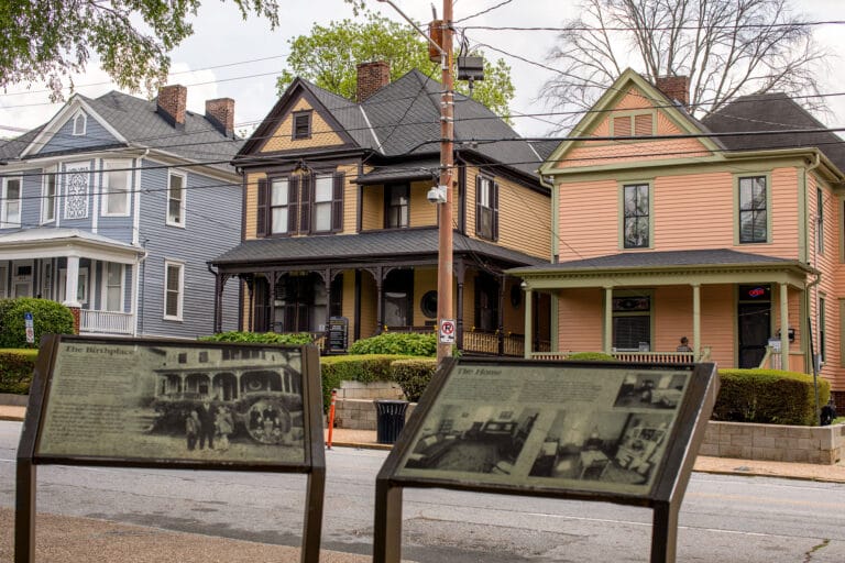
Located one hour west of Atlanta, the Upper Little Tallapoosa River (ULTR), which provides drinking water to the cities of Carrollton, Temple and Villa Rica, encompasses 95 square miles and lies almost entirely within Carroll County, Georgia, in the Piedmont region of the southern Appalachians. Interstate 20 bisects the northern half of the ULTR watershed (i.e., the section above Lake Buckhorn), and the city of Carrollton marks the lower boundary. The river is currently used for drinking water, recreation, and wildlife habitat, and receives treated wastewater discharges from the cities of Villa Rica and Temple.
Land uses in the watershed—traditionally farming, forestry, and low-density housing – are steadily changing due to people moving from Birmingham to the West and Atlanta to the East and settling along Interstate 20. Rapid residential/commercial development and onsite wastewater impacts in the northern half of the watershed, urban runoff from Villa Rica and Temple, loss of riparian vegetation along the main channel and tributaries, and fragmentation of forest habitat have caused concerns that water quality in the ULTR may be degraded.
Challenges
Located one hour west of Atlanta, the Upper Little Tallapoosa watershed in Carroll County, Georgia provides drinking water to the cities of Carrollton, Temple, and Villa Rica. Carroll County is currently experiencing rapid growth, a proliferation of on-site septic systems and intensive agriculture, which has led to water quality problems with high levels of fecal coliform, sediment and organics.
Successes
Citizens passed a special purpose local option sales tax by an overwhelming (67%) majority in the November 2003 election, raising $20 million to pay for land conservation that protects source water and an additional $60 million for other capital projects, including improved wastewater management.
The Trust for Public Land, working with Carroll County, secured an option on a critically important 252-acre forested parcel that was slated for conversion to a large residential subdivision. The parcel protects 3,600 feet of the Little Tallapoosa River and a large wetland at the confluence of several smaller tributaries. Increased attention on the potential problems associated with animal agriculture and timber harvesting led to an agreement to form an Agricultural and Woodlot Owners Council to improve BMP design and implementation.
In addition, funding has been secured through Section 319 to hire a watershed inspector to enforce soil erosion and sediment control regulations, which will help to reduce turbidity, nutrient loading, and the precursors of disinfection by-products.
Phase 1: Source Water Analysis
Threats to Source Water
The primary threat to water quality in the Little Tallapoosa is animal and human waste, measured by high fecal coliform levels. These wastes are washed off pastureland when it rains, are discharged by wastewater treatment plants and seep into the groundwater, and eventually into streams, from failing septic systems. High fecal coliform levels are also an indicator of possible contamination by pathogens, such as Cryptosporidium, E. coli and giardia. In 1987, the Little Tallapoosa had one of the first major outbreaks of Cryptosporidium in the nation, sickening 13,000 of the 65,000 residents in the county.
Sediment is another contaminant of concern in the Little Tallapoosa. Sediment is washed into streams from land that has been cleared of vegetation, such as construction sites, forest clear cuts, or other soil disturbance areas, such as stream banks trampled by cattle or tilled cropland. Sediment often carries pathogens, pesticides, nutrients and organic debris, which makes water treatment more difficult and expensive and threatens human health. High levels of organics in the source water have also led to elevated disinfection by-products in the finished drinking water.
GIS Analysis
The GIS analysis was conducted using a new GIS Mapping Methodology. At the watershed scale, the results of the overlay processes show general areas that could have a disproportionate (positive or negative) influence on water quality. The juxtaposition of forests and agricultural land can have a range of consequences. For example, a large intact block of forest can assimilate and transform nonpoint source pollution from agriculture, construction, or timber harvesting. Alternatively, inappropriate land use may pollute water above or below a forested reach. Headwater tributaries may exhibit substantially different flow regimes and ambient water quality because of the contrast between land cover and land use.
Financing Opportunities
- Pass the Special Purpose Local Option Sales Tax (SPLOST) in the November 2003 election and dedicate a portion to land conservation specifically for the purpose of protecting source waters.
- Use funding from the Georgia Greenspace Grant Program: Carroll County received $230,000 in 2001 and received roughly $279,000 in 2002.
- Take advantage of funding in the Federal Farmland Protection Program: With the significant increase in funding available under the most recent Farm Bill, Carroll County may apply for an FPP grant, possibly in conjunction with the Carroll County Farmland & Rural Preservation Partnership.
- Expand Forest Legacy Program boundaries to include Carroll County: The recently completed FLP Assessment of Need (AON) includes a Mountain Forest Legacy Area that borders, but does not include, Carroll County.
Phase 2: Implementation
The following ten action strategies were developed at the Implementation Meeting held September 23, 2003. The development of these strategies represents the culmination of 18 months of research, planning and and the Stewardship Exchange meeting.
Inspect and enforce on-site septic systems.
Monitor impact of changing land use on water quality. Create an annual report that informs residents on whether and to what degree water bodies meet standards, linking land use changes to water quality changes.
Educate landowners on Farm Bill cost share programs in order to increase participation, possibly through the creation of an Agricultural and Woodlot Owners Council modeled after the Ag and Woodlot Owners Council in the NYC Watershed.
Protect sensitive land from development, particularly large properties vulnerable to development. Use the maps produced by the University of Massachusetts to identify the highest priority areas for protection.
Pass SPLOST.
Assess dioxin contamination throughout the watershed.
Assess adequacy of existing buffer protection and whether they are being properly enforced.
Improve growth management, identifying areas where growth should be discouraged to minimize impact on water resources.
Protect land necessary for future wastewater treatment needs.
Conduct a cost-benefit analysis on the impact of development and loss of forests on treatment costs.
Since the implementation meeting, the community has made significant progress on implementing their agreed upon strategies, including:
- The SPLOST was passed projected to generate approximately $60 million, and setting aside over $20 million for land conservation to protect source water.
- Over 260 acres of key forested land with small streams have been permanently protected.
- A new Erosion and Sediment Control Inspector has been hired with Section 319 funding.
- Expanded monitoring is being conducted by the watershed association and West Georgia University.
- A team of academics, including economists, natural resource conservationists and others has been assembled to conduct a cost-benefit analysis on the impact of development on treatment costs.
- A new County Comprehensive Plan integrates growth management and water resource protection strategies into local land use plans.
The Antiquities Act is one of America’s most effective conservation laws—it has created some of the most popular national parks, including scenic wonders like the Grand Canyon. But this critical conservation tool is under attack. Urge Congress to protect the Antiquities Act today!


Donate to become a member, and you’ll receive a subscription to Land&People magazine, our biannual publication featuring exclusive, inspiring stories about our work connecting everyone to the outdoors.
See how our supporters are helping us connect people to the outdoors across the country.