Taylor Fork
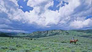
In the 19th century, the federal government granted large quantities of Western land to the railroads as a way to encourage development. The government granted the land in alternating square-mile sections, leading to a checkerboard pattern of public and private landholdings that still exists today. These private parcels are often prime land for wildlife and recreation, and their development can frustrate the efforts of federal land managers to manage adjacent public lands for the highest and best use. In July 2003, TPL completed the second phase of this project, helping protect close to 3,400 acres of checkerboard land in the famous Taylor Fork drainage, northwest of Yellowstone National Park. The protection of this prime elk and grizzly bear habitat brings into public ownership one of the last, large remaining blocks of unprotected private land in the Gallatin National Forest.